Are you planning a trip to Florida? From historic St. Augustine to the funky Florida Keys, there’s a travel experience for every interest. But For boomers who enjoy a scenic drive, be sure to add a Big Bend Scenic Byway road trip to your Florida road trip itinerary.
When you’ve had enough of beaches, enjoying a boomer adventure on one of the Florida scenic highways is a great change of pace. Let’s head straight to the panhandle to get started on a trip that explores nature’s beauty on the Gulf Coast of Florida.
James Richardson and his wife enjoyed a wonderful trip in this corner of Florida. Read his tips for a road trip along Big Bend Scenic Byway on Florida’s Forgotten Coast. Whether you’re looking for a walk on a forest trail, experiencing rich heritage, or adventuring in national wildlife refuges, you’ll find something fun to do.
There is a part of the state of Florida that brings to mind the way the Sunshine State used to be, before the elaborate development and all the high rise condominiums. Granted, it’s nice to stay in one of those grand buildings situated on beautiful white sandy beaches and enjoy the convenience of nearby restaurants and shops.
But, my bride of 54 years and I have often wondered if there was a part of Florida that remains the way it used to be. So we drove Highway 98 (and other portions of the Big Bend Scenic Byway) in search of fun things to do in Old Florida.
On a road trip along the Big Bend Scenic Byway (official website here), we discovered a part of Florida that’s less developed. Many people do not realize, or have even heard of Florida’s Big Bend National Scenic Byway, but it passes through some of the state’s most natural and non-commercialized areas.
Table of Contents
Where is the Big Bend Scenic Byway?
The 220-mile long Big Bend Scenic Byway travels through parts of four counties, three state parks, a national forest, a national wildlife refuge, and several small coastal fishing villages. It is basically a loop tour with a few spurs, one of which goes to the town of Apalachicola, the largest town along the byway.
The Byway is accessible from Apalachicola in the west (about 55 miles southeast of Panama City), Tallahassee in the north, or Newport in the east. The more populous areas of the byway in Franklin County are the areas of Apalachicola, Eastpoint, and St. George Island.
Franklin County, one of the four counties, contains a large portion of the Big Bend Scenic Byway, which follows US Highway 98 along the coast and through the small fishing towns of Carrabelle, Eastpoint, Lanark Village, St. Teresa, and Alligator Point. You’ll find plenty of things to do along Highway 98.
Other roads, or spurs off the byway, take visitors through the state and national forests, and onto St. George Island.
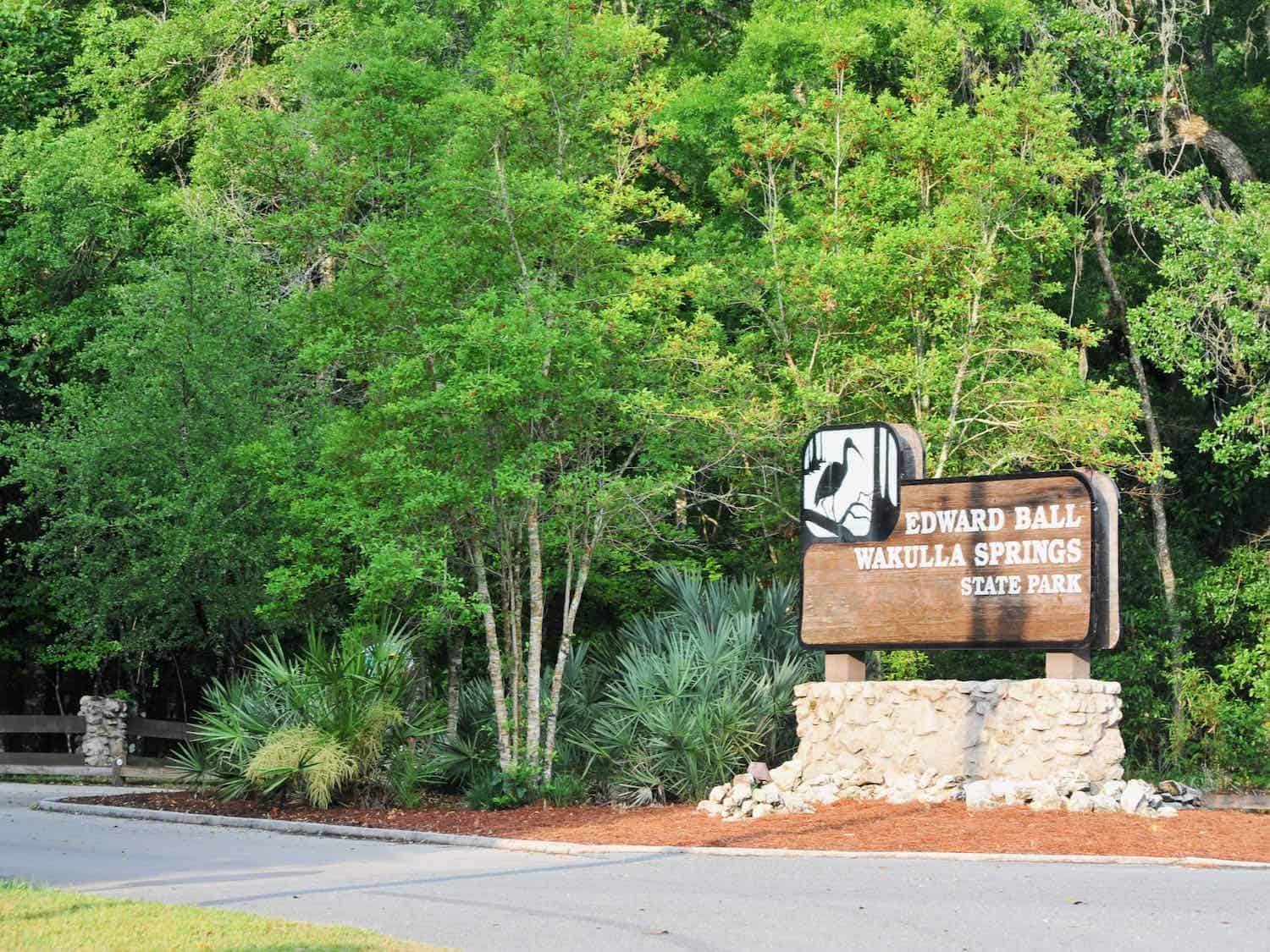
The route borders the Apalachicola River Wildlife and Environmental Area and Tate’s Hell State Forest, and passes through the Apalachicola National Forest and St. Marks National Wildlife Refuge. The byway is adjacent to Bald Point State Park, Ochlockonee State Park, and Edward Ball Wakulla Springs State Park.
Of course, we found three lighthouses to explore. With all these points of interest, my wife and I spent much time enjoying the outdoor recreation along this scenic byway, including hiking and wildlife watching.
Boomer Travel Tip
Make the most of your road trip by downloading a Big Bend Scenic Byway map here.
Visit Apalachicola for historic homes and oysters
The town of Apalachicola has many restaurants, shops, and historic spots to visit. Once the third largest port on the Gulf of Mexico, Apalachicola’s diverse and colorful past is still evident.
There are over nine hundred historic homes and buildings in the National Historic District. We strolled through the district with a self-guided walking tour and managed to see several of the historic homes that date back to the 1830s.
You’ll find downloadable self-guided walking tours at the Franklin County visitors website.
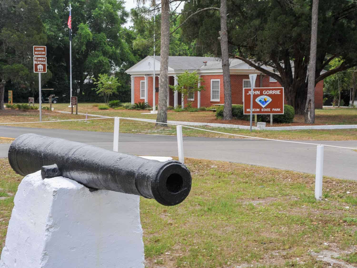
There are several interesting museums, one of which is the John Gorrie Museum. It contains a replica of the ice machine invented in 1851 by Dr. Gorrie, who was a medical doctor working to find a cure for yellow fever.
The invention of the ice machine was the result of Dr. Gorrie’s research. He also received the first U.S. Patent for mechanical refrigeration i 1851. The museum is on the grounds of John Gorrie Museum State Park (website here).
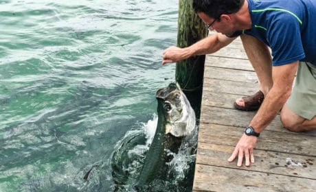
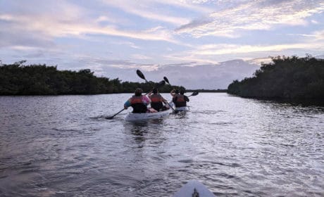
Apalachicola is situated at the mouth of the Apalachicola River. The river and bay provide great opportunities for both fresh and salt water fishing enthusiasts. We did not do any fishing but did kayak in some of the coves in the bay and the river.
Did you know that Franklin County harvests more than 90% of Florida’s oysters and 10% of the oysters consumed in the nation? You can see why this is the place to visit for seafood.
Boomer Travel Tip
If you want to limit your drive to the coast, here’s a map for the Big Bend Scenic Byway Coastal Trail.
Drive to St. George Island for a lighthouse view and hiking
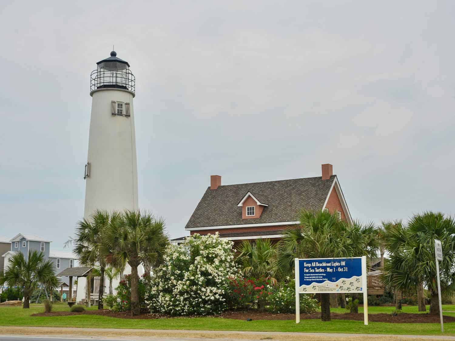
From Apalachicola, we took one spur of the byway, SR 300, and headed to the 28-mile long barrier island of St. George. The route crosses a four-mile bridge over Apalachicola Bay to St. George Island providing a great view of the bay.
Our first stop was at the prominent Cape St. George Light at the intersection of SR 300 and Gulf Beach Drive. This trip, my bride and I climbed to the top of the lighthouse for good views of the island. Parking is plentiful plus there is access to the beach.
The Cape St. George Light sits at the center of St. George Island. The first lighthouse was built in 1833 near West Pass. Due to difficulty for maritime traffic to see it when approaching from the east, the light was dismantled and rebuilt using its same bricks and was completed in 1848.
The second lighthouse was knocked over during a hurricane in 1851. The next year the third lighthouse was completed, again using the same materials but this time the lighthouse was moved further inland from the water.
The lighthouse saga continued. Hurricanes have been very detrimental to it. Hurricanes Opal and George damaged the lighthouse and finally the tower collapsed in 2005. In 2008, Cape St. George Light was rebuilt and reopened.
At the eastern end of St. George Island the state park of the same name, actually it’s the Dr. Julian G. Bruce St. George Island State Park, has nine miles of undeveloped shoreline. There are large sand dunes, forested areas, and salt marshes. Day passes are $6 per vehicle (2 to 8 people) and can be purchased ahead of time online.
In October 2018, Hurricane Michael severely damaged the state park as well as St. George Island, plowing through sand dunes and destroying facilities. As of 2024, the park is back to normal.
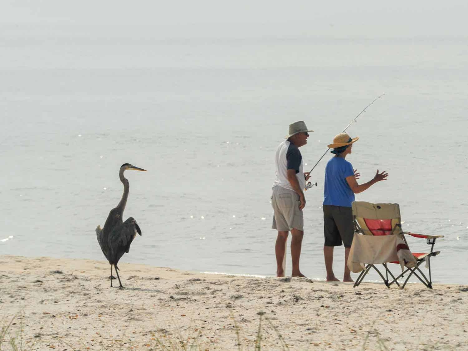
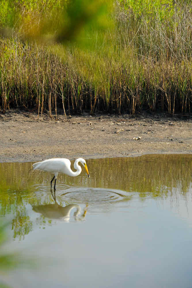
St. George Island State Park includes a series of hiking trails, boardwalks, and observation platforms. We spent a good bit of time on the trails looking for unusual species of birds. Shelling and stargazing are also popular activities.
Several rental companies have properties along the beach and the bay side, but no high rises. Booking a vacation rental from an owner is also a good option.
We stayed at the campground at the state park for a few nights. It was nice to be so close to all the activities that this Florida island has to offer.
Explore Eastpoint and Carrabelle for fishing and history
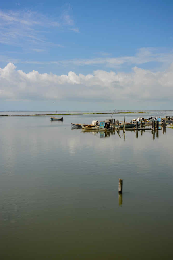
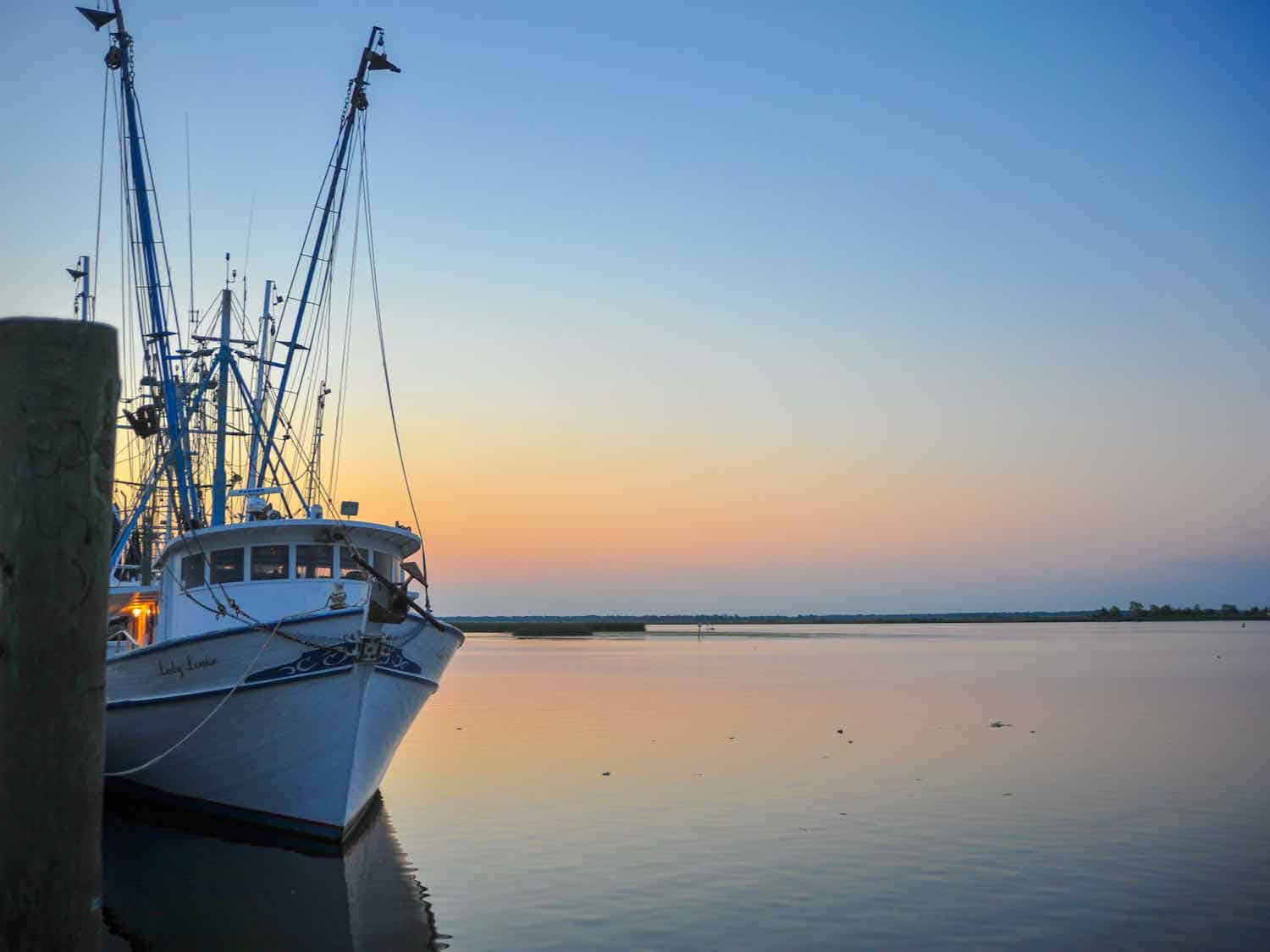
After our stay on St. George Island, we headed back across the long bridge to pick up the main leg of the byway once again. Traveling eastward brought us to the town of Eastpoint, one of several fishing towns along the coast. Many of the oysterman harvest their catch and bring it here for processing.
From Eastpoint the route goes toward Carrabelle along St. George Sound.
Carrabelle has a couple campgrounds. One, the Carrabelle Beach RV Park, has rental cabins that would afford good access to the Big Bend Scenic Byway and the attractions along the route. You’ll also find a wide assortment of vacation rentals.
We discovered an interesting fact while in Carrabelle. The beach along this portion of the byway served as a training ground for the amphibious assault on Normandy Beach during World War II because of the similarities in the geography of the area.
Cape St. George Island (to the west of St. George Island) was used as practice ranges for the B-24 bombers. The Camp Gordon Johnston WW II Museum is dedicated to that time in Carrabelle’s history.
The camp trained a quarter of a million men for the war. It closed in June 1946.
Past Carrabelle the loop of the byway splits at US 98 and US 319. The northern portion (US 319) goes through the Apalachicola National Forest (website here) on another state highway, passes through the Fort Braden community, before arriving near Interstate 10 and Tallahassee.
In 1839 Fort Braden was established as a military fort during the 2nd Seminole War. It was located on the Ochlockonee River eighteen miles southwest of Tallahassee.
Boomer Travel Tip
Want to go off-the-beaten-path? Reserve a ferry spot for a weekend ride to Dog Island, 3.5 miles offshore from Carrabelle. The Nature Conservacy owns most of the 6.8-mile-long island, however there are about 100 residences (please respect their privacy). While there are no amenities (bring everything with you), walking the unspoiled beaches is worth the effort. More details here.
Stop at St. Marks National Wildlife Refuge and Lighthouse
The byway takes a southern bend through the Wakulla State Forest toward Newport where the route rejoins US 98. From Newport there is an option for another spur to St. Marks National Wildlife Refuge and Lighthouse.
We took this spur and followed it to the refuge (website here) which has the designation of a National Natural Landmark due to the fact that it contains habitat for over a dozen rare and endangered species. Encompassing 68,000 acres, St. Marks is one of the oldest refuges in the country. It was established in 1931 as a wintering ground for migratory birds.
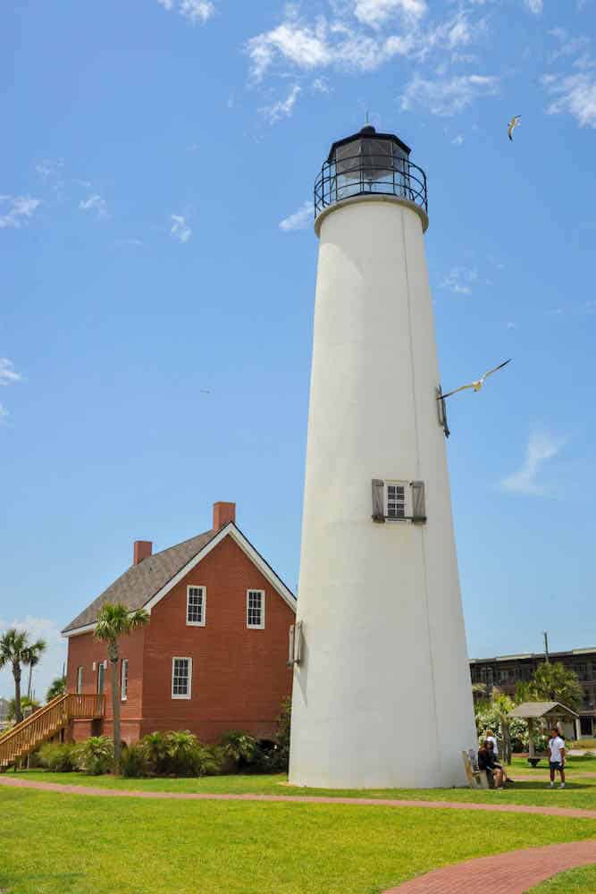
We drove through the refuge and found the St Marks Lighthouse. The “Beacon on the Bay” is the second oldest lighthouse in Florida.
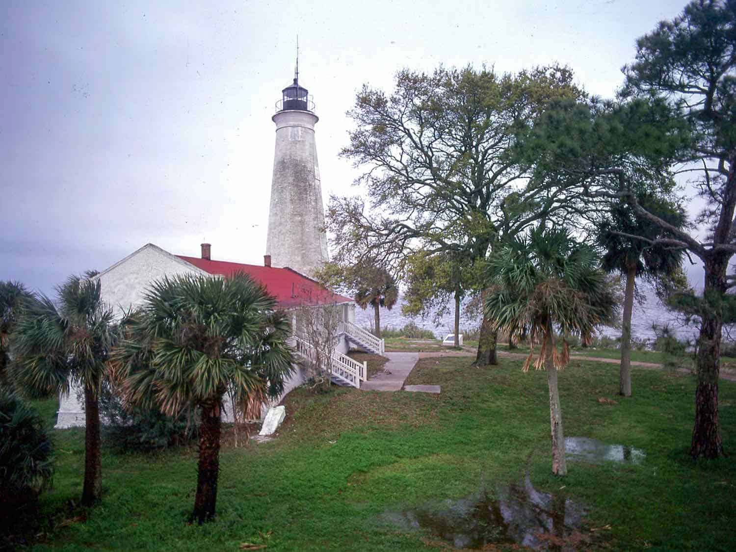
The first lighthouse at St. Marks was finished in 1831, but had to be rebuilt because of erosion. The present tower was built on the current location in 1842.
The grounds consists of the lightkeeper’s house which is attached to the 88-foot tower. According to local legend, the limestone blocks are from the ruins of the old Fort San Marcos de Apalachee, which is located north of the lighthouse and is now a state historic park.
The other part of the split (US 98) continues along the coast past Alligator Point and Bald Point State Park and across the Ochlockonee River. Alligator Point, where Ochlockonee Bay meets Apalachee Bay, is an ideal stopover for visitors wanting a more isolated destination.
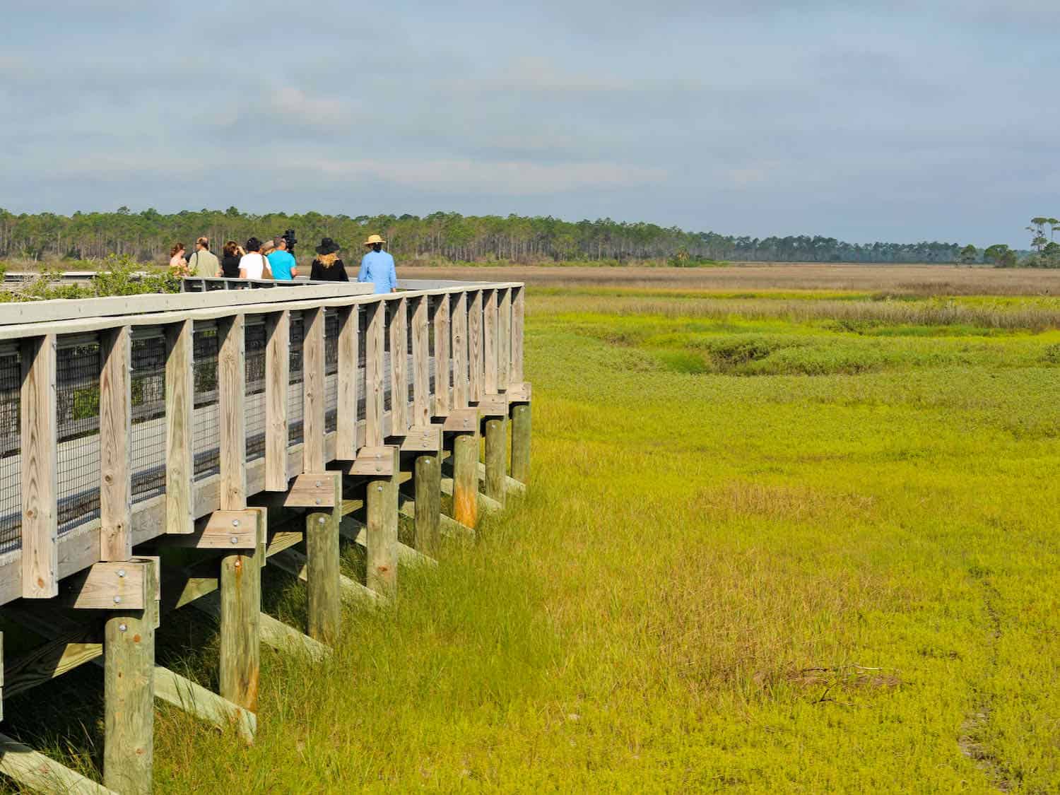
With over 4,000 acres of coastal marshes, hardwood forests and pine flatwoods, Bald Point State Park (website) offers a multitude of land and water activities. It’s a popular destination for birding and wildlife viewing.
Each fall bald eagles and migrating birds, along with monarch butterflies, stop over during their trip south for the winter. I appreciated the excellent location for photography of wildlife of all kinds.
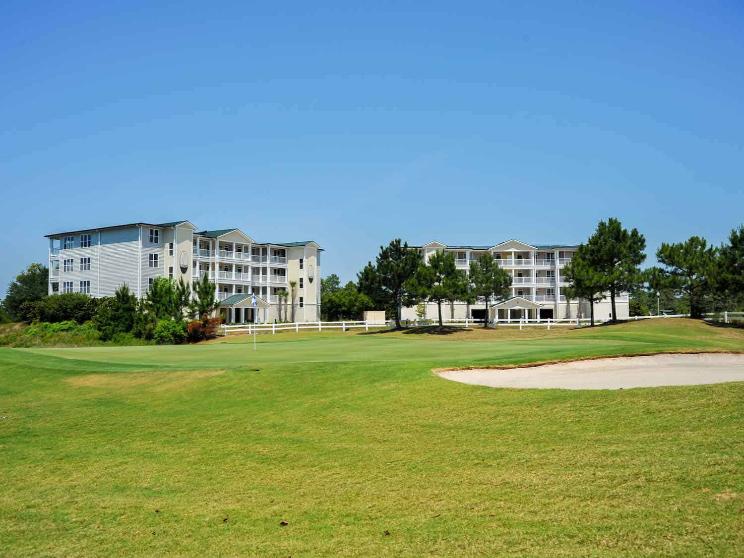
We returned back westward toward Carrabelle to stop over at the St. James Bay Resort for one day. This resort is ideal for golfers. Located in Carrabelle, it’s another good option for accommodations.
The St. James Bay Resort Golf Course is Audubon certified, which means the natural environment was minimally disturbed during its design. The accommodations are low-rise condominiums and villas with the Crooked River Grill on site.
Boomer Travel Tip
Use our road trip planner to make the most of your next road trip adventure.
Learn about Tate’s Hell State Forest
After relaxing at St James, we made a stop at Tate’s Hell State Forest (website). With such an unusual name there must be a story.
Local legend has it that an area farmer by the name of Cebe Tate, armed with only a shotgun and accompanied by his hunting dogs, journeyed into the swampy portion of the forest in search of a panther that was killing his livestock. Tate became lost in the swamp for seven days and nights, was bitten by a snake, and drank from the murky waters to quench his thirst.
Finally, he came to a clearing near Carrabelle, living only long enough to utter the words, “My name is Cebe Tate, and I just came from Hell!” Cebe Tate’s adventure took place in 1875 and the area has been known as Tate’s Hell ever since. Sounds good to me.
Tate’s Hell State Forest is comprised of 202,437 acres of land mostly in Franklin County. It lies between the Apalachicola and Ochlockonee Rivers.
The natural resources found here are very diverse because of the unique and various natural habitats. Many species of wildlife are residents of the forest including the bald eagle, Florida black bears, gopher tortoise, and the red-cockaded woodpecker.
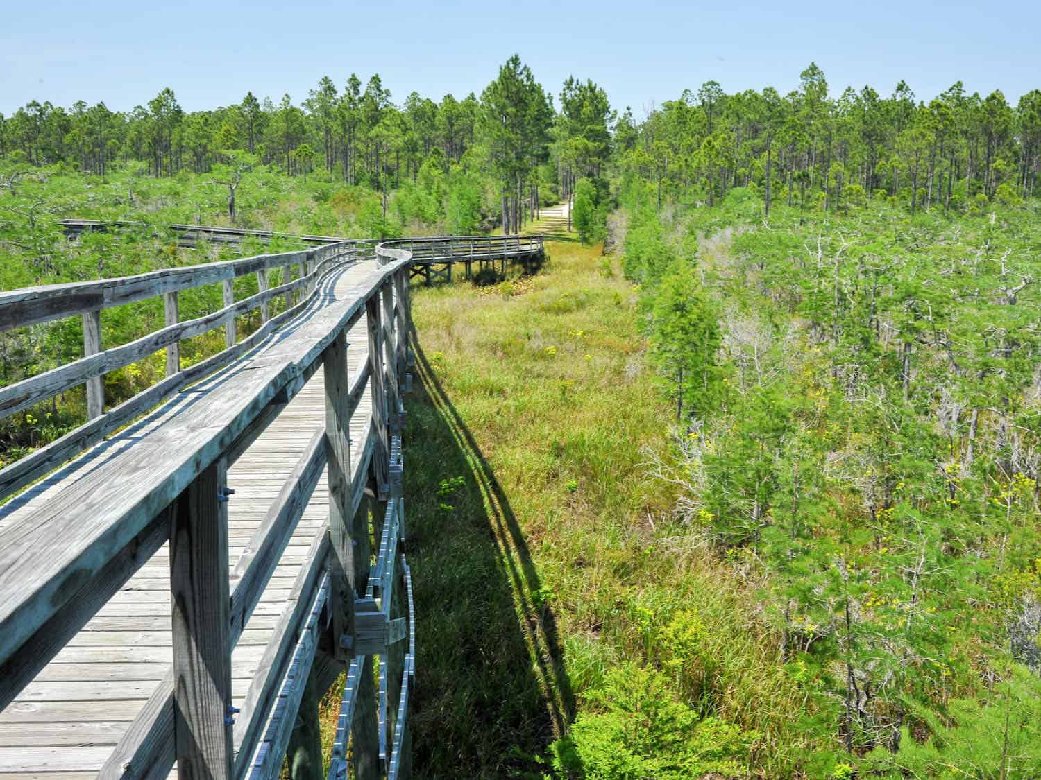
There are also rare plant species living on the forest. Unique flora of Tate’s Hell State Forest are its dwarf cypress trees, which only reach six to seven feet tall, with most being over 100 years old. A boardwalk with a thirty-foot tall observation tower overlooking one of the most prolific areas is accessible by way of a drivable five-mile forest road off US 98 near Carrabelle.
Climb Crooked River Lighthouse
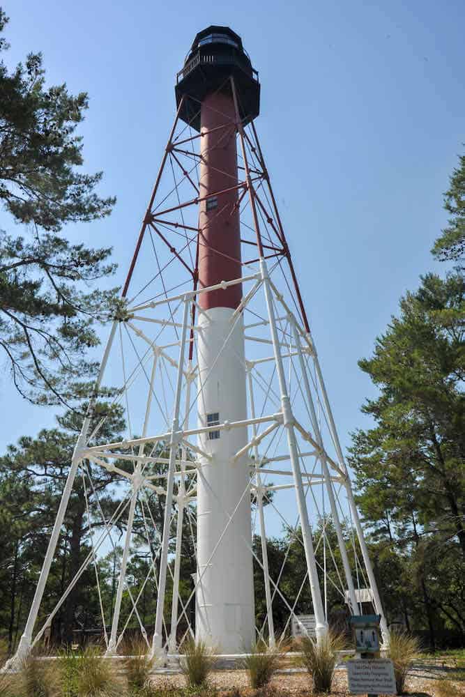
About two miles east of Carrabelle along US 98, we stopped by 112-year old Crooked River Lighthouse (website). It has a cast iron skeletal tower on a cement foundation with a height of 103 feet.
Visitors can climb the 138 steps to the top on Wednesday through Sunday. Check the website for times. We arrived on a day that the lighthouse was not open for climbing.
The Big Bend Scenic Byway is less commercial and less developed than many parts of Florida. That makes this scenic drive extra special.
This was a self-planned road trip. I recommend browsing the byway’s website before your journey (we didn’t). It will introduce you to the scenic byways’ many attractions, allowing for better use of your travel time. Despite this faux pax, our Big Bend Scenic Byway road trip was very rewarding.
Extend your road trip on the Gulf Coast
After exploring Florida’s Big Bend Scenic Byway, keep on driving the Gulf Coast.
Drive West into Alabama where James Richardson will show you the best things to do on the Alabama Gulf Coast.
Continue into Mississippi by following Teresa Otto’s Mississippi Gulf Coast 3-day itinerary.