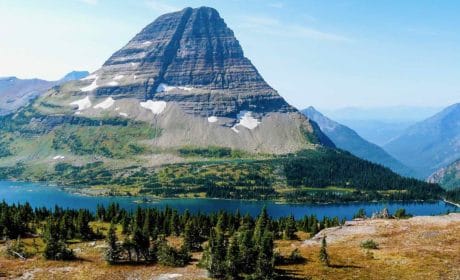
If you’re visiting the Bitterroot Valley, a new resident, or an old timer, hiking Kootenai Creek Trail #53 is a must. This green oasis of a forested hike travels next to Kootenai Creek for a good part of the journey.
As Bitterroot Valley residents, Alan and I hike this trail as often as we can. It’s one of our favorite things to do in Stevensville, Montana.
Grab the hiking gear, pack a lunch in your backpack and get ready for a beautiful day of Montana hiking in the Bitterroot Mountains. Kooetnai Creek here we come.
Alan and I use Hiking the Selway-Bitterroot Wilderness, a Falcon Guide, to plan our hikes in the Bitterroot Valley.
What to expect on a Kootenai Creek trail hike
Arriving at Kootenai Creek trailhead, you’ll find adequate parking, hitching rails and a stock ramp—just in case you brought your horse—and the all-important vault toilet. There are also signs advising how to hike safely in this part of the Bitterroot National Forest.
And, yes, bring bear spray—a must for any Montana hiking trail.

Hiking next to Kootenai Creek is truly a delight as it tumbles over rocks and boulders for a good part of the trail. In early summer, the water rages through the canyon. However later in the season, waters calm down enough for fishing from the shore or dipping your toes in the cold water.
On the portions of the path that we’ve hiked, the trail meanders at creek level for about .5 miles before heading up the hillside on a steady, but easy, uphill climb. Rocks along the path make for tricky footing so wear good hiking shoes.

Although poles aren’t necessary for most folks, if you have any type of balance issues—like me—hiking poles will come in handy. And they’ll also relieve the pressure on joints—especially knees—on the downhill trek back to the trailhead.
Boomer Travel Tip
Need to gear up? Check out my recommendations for day hiking essentials.
At approximate the 9 mile mark you’ll find Kootenai Lakes—a series of alpine lakes at the 6,000 elevation mark, which is about a 2,600 feet gain in elevation from the trailhead. Since our backpacking days are over (actually mine never happened), Alan and I agree that we’ll most likely never make it to Kootenai Lakes.

Unless you’re hiking all the way to the lakes, I recommend going as far as you like up the glaciated canyon and then turning around for the downhill walk back to the trailhead. We’re satisfied to hike 2 and 1/2 miles to the sign that designates the entrance to the Selway-Bitterroot Wilderness before turning around and heading for home. The 5-mile-round-trip hike is just about right for moderately fit boomer hikers like us.
Our Kootenai Creek hiking experiences

Our Kooetenai Creek hiking day usually go like this: When we start our hike around 7 a.m., the trail belongs to us for about the first two hours, although we do have to be vigilant for gifts that horses have deposited along the way—Kootenai Creek Trail is multi-use.
On the return portion of the hike, the traffic picks up. We meet hikers of all ages on the trail, many bring their dogs along and some are toting a fishing pole as they look for just the right spot on the creek for fly-fishing. It’s a friendly crowd and, every time, we return to the trailhead with lots of advice for the next hike.
Directions to the Kootenai Creek trailhead

Coming from the North on Highway 93: Kootenai Creek Road is 6.9 miles south of Florence. Turn right (west) onto Kootenai Creek Road for the 2-mile drive to the trailhead.
Arriving from the South: At the junction of the Stevensville Cutoff Road and Highway 93, drive 1 mile north on Highway 93. Turn left (west) onto Kootenai Creek Road and continue 2 miles to the trailhead.
Where to stay in Stevensville, Montana
Stevensville offers the closest lodging to the trail. If you like to stay in bed and breakfasts, I recommend Bitterroot River Bed & Breakfast. Located on the river and just a short walk from Main Street in Stevensville, the hearty, delicious breakfasts are the perfect start to your Bitterroot hiking day.
Stay at The Stevensville Hotel for an in-the-center-of-town experience that includes easy walking to restaurants, shopping and Blacksmith Brewing Company.
More things to do in the Bitterroot Valley
The Bitterroot Valley is an outdoor lover’s paradise. If you’re looking for a scenic drive that’s off-the-beaten path, follow my tips for visiting Twin Lakes.
Day Hiking Essentials Shopping List
Would you rather purchase day hiking essentials all in one place? This Amazon shopping list makes it easy for you to buy what you need to be out on the trail in no time. Happy shopping!

Columbia Women's Benton Springs Full Zip Jacket, Soft Fleece with Classic Fit
A fleece jacket is perfect when your day hike begins on a cool spring or fall morning. Once you warm up, tie the jacket around your waist. That's what I do. It's also lightweight enough to easily stuff into a backpack. Buy one of the bright colors so your photo stands out from trail scenery.

Kirkland Signature Ladies' Water-Repellent Wind Resistant Softshell Jacket
This Kirkland jacket comes in many colors (I don't recommend black if you'll be wearing this in photos). I wear my red Kirkland Signature jacket on almost every adventure. The lining adds a bit of warmth, plus the outer shell is water repellent and wind resistant.

Genius Earth Travel/Hiking/Walking Fanny Pack
How do we carry gear on a day hike? For short hikes, our choice is to wear a waterproof fanny pack that holds a water bottle on each side of the pack.

BAFX Adjustable Anti Shock Aluminum Hiking Poles for Walking or Trekking
Hiking poles take the pressure off hips and knees, especially on downhill portions of the trail. If you have a fear of heights, like me, hiking sticks offer stability and security.

HotHands Toe, Hand and Body Warmer Variety Pack
Your hands and toes will thank you for carrying adhesive warmers in your pack. They're perfect for when colder weather surprises you on the trail.
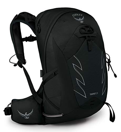
Osprey Packs Tempest Women's Hiking Backpack
The Osprey Tempest comes with cushioned shoulder pads and comfortable hip belts. It's my backpack choice for day hikes where I need to pack more gear in anticipation of changing weather conditions.
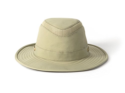
Tilley Endurables LTM6 Airflo Hat
My Tilley Endurables hat protects me from the sun, plus the mesh airflo vent keeps my head from overheating.

KEEN Women's Targhee Waterproof Hiking Boots
For rocky trails, I wear a tough hiking boot like the Keene Targhee.

Darn Tough Vermont Hiker Boot Full Cushion Sock
Darn tough cushion socks keep my feet dry and comfortable. Good hiking socks provide essential cushioning for those long days of exploring.

Columbia Women's Standard Saturday Trail II Convertible Pant, British Tan, 6 Regular
These stretch hiking pants look good enough to wear around town. The convertible feature is handy for warmer days. And, ladies, these Columbia pants also come in plus sizes.

LifeStraw Go Water Filter Bottle
The LifeStraw has a 2-stage integrated filter that protects against, microplastics, chlorine, organic chemical matter and sand, dirt, cloudiness and more. And your water will taste better, too!

HESTYA 4 Pack Mosquito Head and Face Netting
Avoid mosquito and insect bites with the Hestya mosquito head and face netting. Place the head netting over a hat and your neck and face will be protected. Comes in a set of four. This is perfect if you only occasionally hike in mosquito prone areas. Also easy to pack in your luggage.

Cliganic 10 Pack Mosquito Repellent Bracelets
Wear these DEET-free mosquito repellent bracelets on your wrists and ankles to avoid bug bites on the trail. Each coil is individually wrapped in a reusable pouch. The essential-oil infused coils last for 10 days or 250 hours.
I’ll be adding more outdoor adventures in the Bitterroot Valley as I complete first-person articles as a Stevensville resident on hiking and exploring this area of Western Montana. Be the first to know by signing up for the My Itchy Travel Feet weekly updates. Subscribe by clicking here.
Save to Pinterest