There’s nothing that Alan and I like better than an off-the-beaten-travel experience, especially if it includes a fun, boomer road trip. Here’s a New Mexico backroads trip that’s one of our favorites. It includes national monuments and out-of-the-way destinations with plenty of history.
Table of Contents
New Mexico backroads trip itinerary starting from Tucson
At the My Itchy Travel Feet page on Facebook (you have clicked the like button, right?). Jennifer asked, “I’m no Boomer, but I’m interested in taking a road trip to New Mexico.
We’ve done Taos and Santa Fe. Do you have any hidden gems that you or your readers suggest we check out this spring?”

Alan and I thought it would be fun to create a New Mexico backroads trip for Jennifer to a secret destination. Well, it’s not really a secret but does involve driving New Mexico backroads to an off-the-beaten-path location. Jennifer, baby boomer or not, this article is for you.
Breakfast on the Salsa Trail
Jennifer, we’re starting this New Mexico backroads adventure from Tucson because, uh, that’s where you live. Tell your husband to set the alarm for an early departure. (Sorry guys, if you want to travel like a boomer, this is part of the deal).
After driving east on I-10 for about an hour, say goodbye to interstate driving at the Safford exit. We’re going off the beaten path. For breakfast, stop at El Coronado Family Restaurant—Mexican or American style—your choice.
Don’t miss Salsa Fest, where a salsa competition, eating contests, entertainment and more will fill your weekend with fun Mexican food memories. Can’t make the festival? Drive the Salsa Trail on your own self-guided food trip.
Scenic drive on Mule Creek Road
From Highway 70 in Safford, go east to make a left-hand turn onto Highway 191 toward Clifton. No, Jennifer, you’re not headed up the scenic Coronado Trail. Instead, take the right turn onto AZ route 78, also known as Mule Creek Road, to enjoy some of our favorite Arizona and New Mexico scenery.
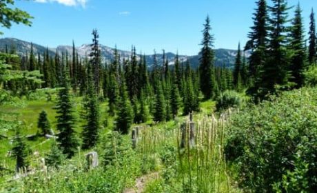
The road twists and turns through the forests of the Gila River Valley before climbing into grasslands. Wait! This looks like Montana. No, you didn’t take a wrong turn—it’s really New Mexico.
Stop to admire the Gila Wilderness view

At Highway 180, turn left. You’ll be cruising up the very western edge of New Mexico. A couple of miles up the road, take a time out at the rest stop.
Get out of the car to stretch your legs and take pictures of the Gila Wilderness. Did you know it was the nation’s first designated wilderness area?
Back in the car, continue driving north on Highway 180. Be sure to stop in Glenwood to purchase picnic supplies. You’re going to need them later today.
Want to explore the Gila Wilderness in depth? Make Silver City your headquarters. Don’t miss the Gila Cliff Dwellings, a 2-hour curvy mountain drive to the north.
Explore Glenwood
Staying at Glenwood is another Gila Wilderness option. There’s very little lodging here so a vacation rental is your best bet.
Be sure to take the one-mile walk on the Catwalk National Recreation Trail. You’ll enjoy this fun look at New Mexico mining history accompanied by outstanding scenery.
Learn about Wild West history in Reserve
After Glenwood, continue north on High 180 through the Gila National Forest. At Highway 12, turn east to explore the wild west town of Reserve—300 residents.
Have you heard of the Frisco Shootout of Elfego Baca? It happened right here at Milligan’s Plaza. After exploring western history, continue on Highway 12 until Apache Creek where you’ll turn north onto Highway 32.
Enjoy a picnic in the woods

As you travel through more of the Gila National Forest, turn onto one of the forest roads to find your spot for a picnic in the woods. Listen to the birds tweet as they dart in and out of the trees. Keep an eye out for deer or maybe even an elk.
Finished with your picnic? Let’s get back in the car, we still have a ways to go.
Highway 32 continues to Quemado, a service center for nearby ranches. Did you find the tree made out of antlers? Hunters flock to the area for its abundant wildlife population of bear, deer, elk and wild turkey.
Admire the lava fields at El Malpais
Pay attention, this is where our trail gets tricky. From Highway 32 in Quemado a quick turn to the right on Highway 60 followed by a left turn onto Highway 36, and another quick right turn onto Highway 117, puts you on a scenic drive by the lava fields of El Malpais National Monument.
Is your camera ready? You might catch the sun setting over the dark volcanic rocks.
At El Malpais National Monument, visitors feel as if they’re looking at a moonscape. Recreation opportunities in the lava-filled landscape include hiking—easy to rugged scenic drives and explorations of the lava formations. However access to the lava caves is no longer available due to National Park regulations.
Welcome to Grants
After leaving the other-worldly views at El Malpais, continue on Highway 117, cross over I-40 and turn left onto U.S. 66. Guess what, Jennifer? You’ve reached the headquarters for your New Mexico backroads trip—Grants, NM.
Pick one of the chain hotels near the interstate for lodging — their convenience makes up for the lack of an authentic experience. Looking for a Mexican dinner? We can vouch for Le Jardin on Roosevelt Avenue.
Boomer Travel Tip
Want to take this road trip? Buy our eguide New Mexico Backroads Weekend Adventure available at Amazon.
Things to do near Grants
There are a surprising number of interesting things to do near Grants. Located about 78 miles west of Albuquerque, it’s a worthy stop if you’re roadtripping through the West on Interstate 40.
El Malpais National Monument
El Malpais National Monument (25 miles west): Drive Highway 53 for access to the El Calderon section for more hiking and scenic views. Beware of driving Chain of Craters Backcountry Byway if it has been raining. The mud turns into hard caliche, which traps vehicles.
A stop by the Visitor’s Center, where a bulletin board features photos of cars stuck in caliche, was enough to discourage Alan from taking a chance on the road — not really —I had to put my foot down.
El Morro National Monument

El Morro National Monument (43 miles west): Another off-the-beaten-path national monument on Highway 53 features petroglyphs and graffiti from the 1800’s carved into stone. Be sure to take Mesa Rock Trail to the top of the rock formations to explore an ancient pueblo.
Chaco Culture National Historic Park
For a really long day trip (round-trip travel time approximately 5 hours), drive 98 miles north to Chaco Culture National Historic Park. More of a primitive experience — roads are dirt — this World Heritage Site explores the remains of the Chaco culture, who mysteriously disappeared around 1200.
Wild Wolf Sanctuary
If you’re an animal lover, continue on Highway 53 through Ramah to the Wild Wolf Sanctuary for a guided tour.
Other lodging options near Grants
Cimarron Rose Bed and Breakfast, located on Highway 53 between El Malpais and El Morro, is another lodging option. Although we have not stayed here, it’s on our list to try for next time. Acoma Pubelo-Sky City (39 miles southeast): an alternate for lodging plus restaurants and a casino.
Return to Tucson
You have two choices on the return trip. Take the easy way out, head west on 1-40 to Flagstaff for an interstate journey that will take you to Phoenix, where I-10 makes a straight path for Tucson.
Or, retrace your steps to Reserve, NM, turn right on Highway 180 to Alpine, AZ and a left turn onto Highway 191. Stay the night a few miles down the road at Hannagan Meadow Lodge, then continue your drive down the scenic Coronado Highway back to Safford, I-10 and Tucson.
Jennifer, what do you think of your New Mexico backroads trip? Do you like our off-the-beaten-path suggestions?
Save to Pinterest


