When looking for a photography hike in Yosemite National Park, you can’t go wrong with the Four Mile Trail. Yosemite is certainly one of the most popular, and beautiful, National Parks in the country. And there’s plenty to photograph.
Guest writer and photographer, Noel Morata from behind Travel Photo Discovery, take us on one of the most photogenic hiking trails in Yosemite National Park, perhaps in all of California.
Yosemite photography hike on Four Mile trail

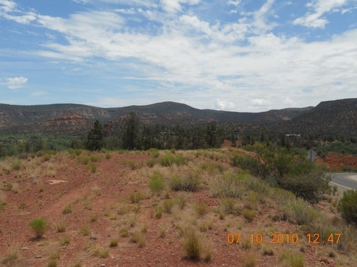
One of my favorite hikes in Yosemite National Park is also one of the most panoramic areas to photograph in the park. The Four Mile trail is around 4.8 miles (7.7 Km) in length in each direction. It takes about 3 to 4 hours to hike the trail one-way—6 to 8 hours if you hike Four Mile trail round-trip.
If you only have time for hiking one leg, you have the option of either hiking the trail uphill from the valley floor to Glacier Point, or taking a shuttle to the top and walking down to the bottom.
The easy way to hike Four Mile trail

Starting from the top of Four Mile trail and going downhill to the various vista points below is a less strenuous hike. The added benefit for starting on top is that you can spend more time enjoying the views while walking around the rim to see the many different vista points at the top of Glacier Point.
From this perspective, you can see many different areas laid out in the park. Take time to photograph Half Dome, Yosemite falls, El Capitan, Nevada falls and Vernal falls as you make your way to the valley floor.

The downhill segment of the trail is relatively easy with many lookout points overlooking the valley floor. Fortunately for hikers, not as many visitors do this trail because of time constraints, limiting themselves to the shorter and more popular trails on the valley floor, however it’s still a popular trail.
Make the effort to include this trail in your visit so that you can experience some of the most amazing views and photo opportunities in Yosemite National Park. Or simply take in the beautiful landscape if you aren’t a photographer.
Starting from Glacier Point

Glacier Point has these huge rounded boulders on the rim that were formed and polished through decades of glaciers grinding and leaving the exposed rocks smooth with their layered striations and granite rock. Fortunately most of the viewpoints are secured with guard rails to prevent visitors from having accidents or creating risks for the national park. But you are allowed to go through many areas around the rim except for a few hazardous ones that are off limits.
At the top of the trail, the relatively easy walk has a gradual decline. Eventually the Four Mile trail becomes more sloped with hairpins through the same areas, which is repetitive. If you hike at a moderately fast pace, it doesn’t get boring.
Have you seen our National Park Travel Planner? Don’t leave home without reading it!
At the same time, if you keep focusing on all the new vistas and gorgeous landscape, you will find interesting botany and landmarks that start to pop up along the trail. Some of the most impressive landmarks that you will see from the trail include Half Dome and El Capitan and all the major waterfalls of the valley.
The trail continues downhill with many hairpin turns and switchback trails that seem to go forever. The good thing is that the views will keep you occupied and busy photographing all the stunning landscape from above while looking down into Yosemite Valley.
When you reach the bottom of the trail, you will be at the Sentinel Rock. From this stop you can catch any of the loop busses that service the entire valley floor to where you are parked or staying for the night.

The hike down to the valley is easy and relatively fast from the top to the bottom floor. Although there are many hiking trails in Yosemite, this route is a highlight of visiting the park.
Those looking for a real workout can start from the Sentinel Rock location and hike uphill to either catch the shuttle from the top or do the same climb down. Another option is connecting with the Panorama trail which is a 8.5 mile (13.6 Km) hike that takes about 6-8 hours to complete for each direction.
For more information about the trails and bus schedules, you can check out the the park’s official website.
Check out our hiking gear shop when planning your Yosemite National Park hiking trip.