Utah’s Highway 12 Scenic Byway is a must-drive for fans of the red, beige and golden-colored rock formations found in southern Utah. Not only is Highway 12 a scenic destination in itself, but there are all those off-the-beaten-path experiences, like driving Burr Trail, to make your trip extra special.
Alan and I are huge fans of exploring the country lanes and dirt roads of the United States. And when it comes to finding adventure in the American Southwest, a bumpy dirt road is the place to be.
On a visit to Grand Staircase-Escalante National Monument in southern Utah, we had our pick of dirt roads and four-wheel-drive trails to explore. But many of those roads are really long, requiring camping on the trail for a night or two.
For an easy half-day drive that leaves time to enjoy lunch on the patio of Kiva Koffeehouse, we recommend driving the Burr Trail. It’s a fun experience in one of the best Utah parks.
Table of Contents
Driving the easy portion of Burr Trail Road
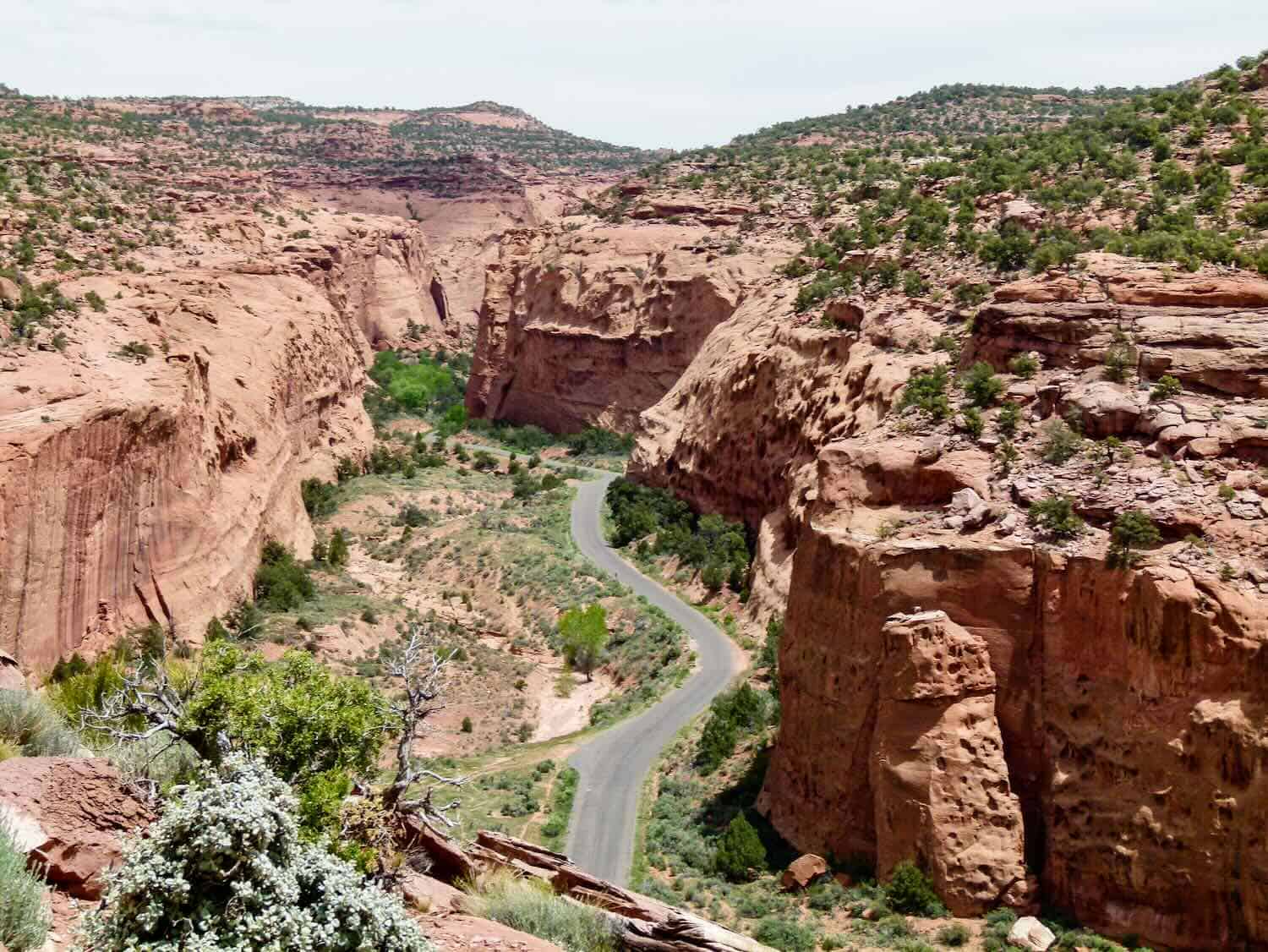
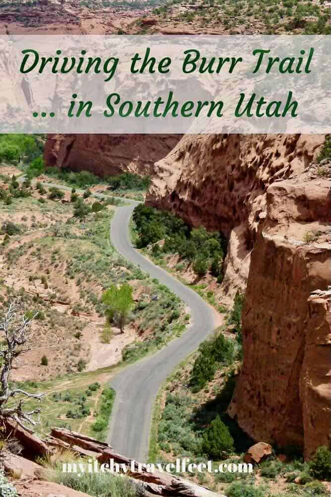
On a late May boomer road trip, the journey starts as we turn off Highway 12 at Boulder, about 32 miles north of Escalante, Utah. Potholes litter the paved road for the first few miles. But once we enter the Grand Staircase-Escalante National Monument portion of Burr Trail Road, the surface smoothes out before descending into Long Canyon.
Boomer Travel Tip
Recreational vehicles are not recommended on the Burr Trail.
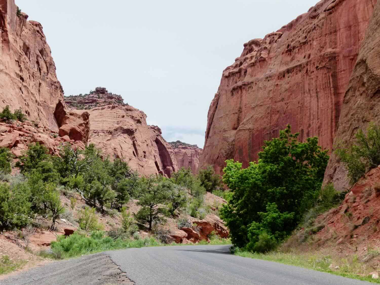
For seven miles, red sandstone cliffs rise steeply on either side of the narrow canyon. Dark brown streaks of desert varnish leave their mark on the canyon walls.
Earlier in the week, on a hike to Lower Calf Creek Falls, we learned that desert varnish is a thin mineral coating caused by living microbes that oxidize iron and manganese found in clay minerals. It also makes for beautiful photos.
Over breakfast at Circle D Eatery in Escalante, our server told us about a small slot canyon to explore on Burr Trail Road that the locals call Singing Canyon. He told us to look for an unmarked pullout in Long Canyon about 11 miles on the Burr Trail from Boulder.
Alan easily spots the pullout and parks the car. We walk slightly downhill, across a sandy path toward a narrow slit in the canyon wall. Where the slit widens, trees with the verdant green of new spring growth decorate the small entrance to Singing Canyon.
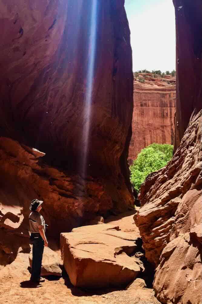
The narrow slot canyon isn’t very long. But it does require scrambling over a few boulders to reach the end.
Why is it called Singing Canyon? Belt out your favorite tune or yell out a few words and the name will become self-evident.
Back in the car, we continue the drive through Long Canyon. Geological colors change from red to yellow and beige as the road climbs out of the canyon.
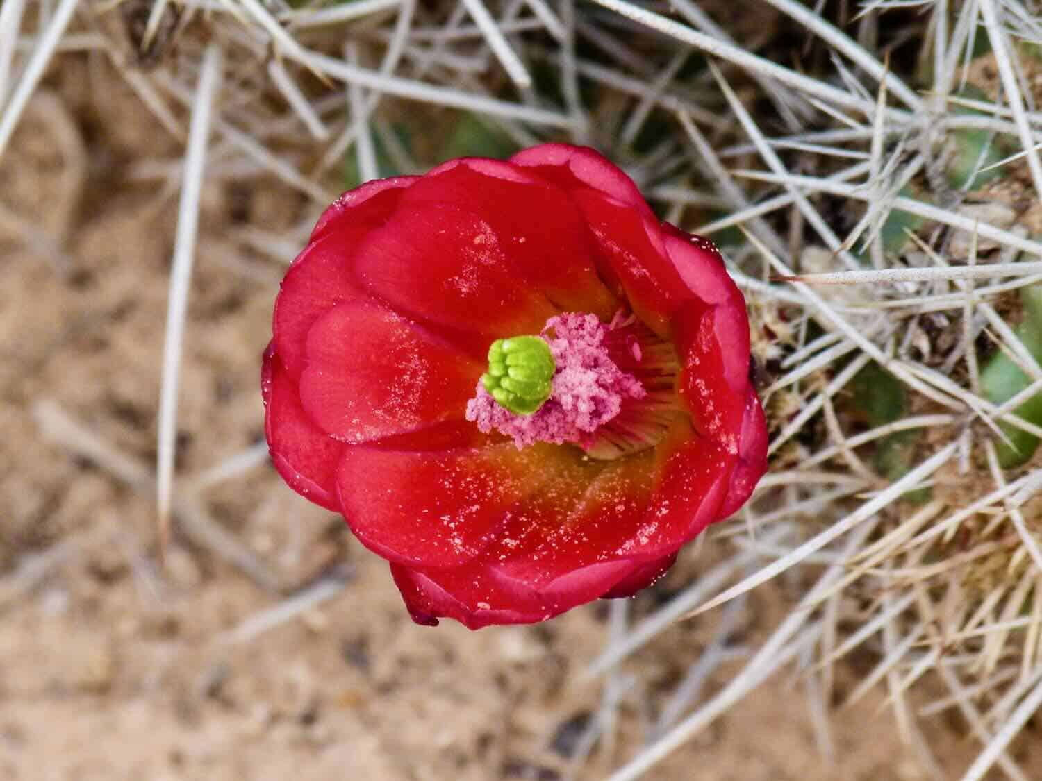
At a crossroads of trails, Alan and I stop again to stretch our legs and explore. Desert cactus and wildflowers are blooming. And we see a few RV’s and tents scattered about in anticipation of Memorial Day weekend.
Boomer Travel Tip
Traveling to Utah? Start your trip research at our Utah Travel Planner page.
The pavement turns to dirt at the western boundary of Capitol Reef National Park—31.2 miles from Boulder. It’s the turn-around point for today’s drive on the Burr Trail.
Up until this point, this has been an easy drive on a paved road that we highly recommend for exploring one of the most remote areas of the wild West. The experience will reward you with a look at the beauty and ruggedness of southern Utah.
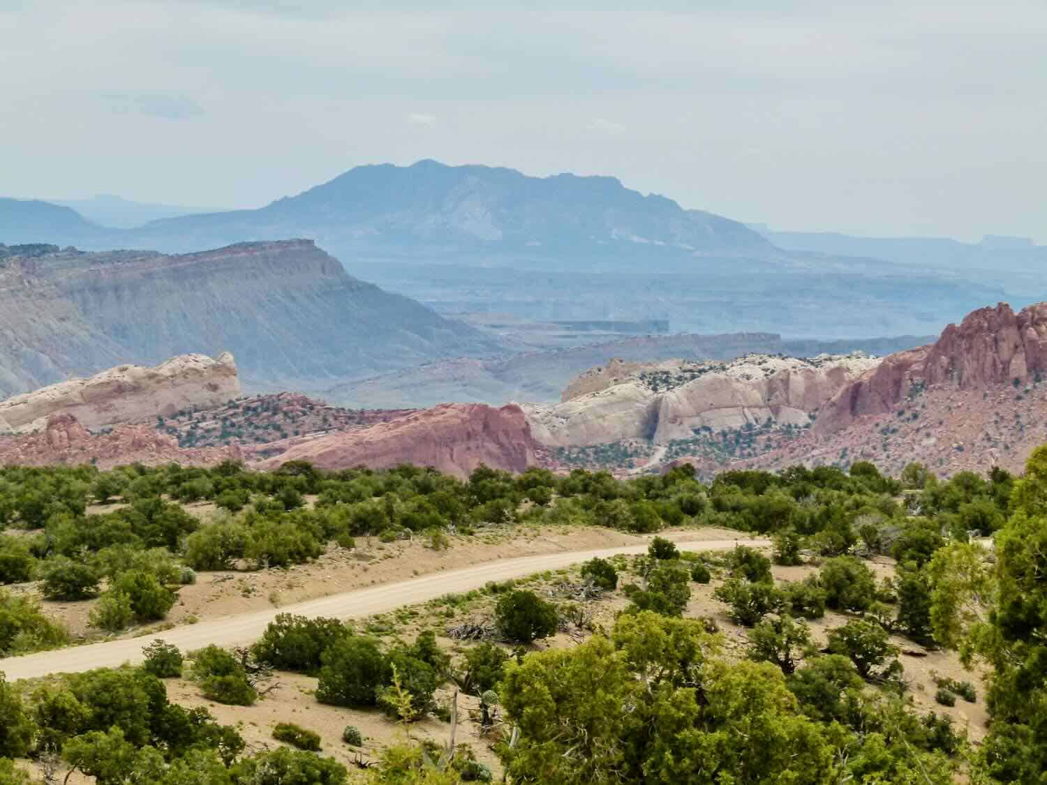
Parking at a scenic viewpoint, we get out of the car again. To say that the landscape is dramatic is an understatement.
Boomer Travel Tip
Need to update your road trip gear? Start with our recommendations for best road trip gear.
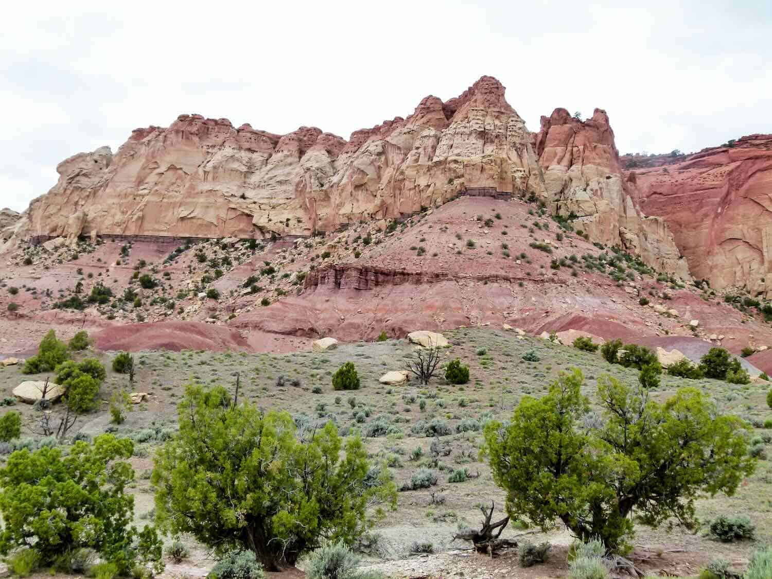
Unfortunately for us, the cloudy weather limits the colorful scene folks usually see. But despite the photographic conditions, amazing geological formations spread out before us: the west side of Waterpocket Fold—a 100-mile bend in the earth’s crust—the Henry Mountains and beyond to the mesas and buttes of Glen Canyon National Recreation Area.
Although we’re turning around, the road continues across the Waterpocket Fold, down a set of spectacular hairpin turns, part of the original cattle trail known as the Burr Trail, until a junction. The left turn, Notom Road, takes visitors on a scenic jaunt to Highway 24 near Torrey, Utah.
But it’s the right turn that Alan and I would like to take one day. The road continues to Bull Frog at Lake Powell.
Driving the Burr Trail Scenic Backway from Boulder to Bull Frog is a 67.4-mile journey that includes a ferry ride across Lake Powell. Leave it to us to seek out the more off-the-beaten-path national park travel option in a remote part of Utah.
Planning Your Trip
The National Park Services has published a mile by mile description of the Burr Trail that is a downloadable pdf.
We used the Benchmark Utah Road & Recreation Atlas to research roads and off-road trails.
Hiking Grand Staircase-Escalante & the Glen Canyon Region, by Falcon Guide, provides detailed hiking trail guides for the area.
Boomer Travel Tip
Looking for a national parks books reading list? Here are our recommendations for 52 of the Best National Parks Books.
Tips for driving the Burr Trail, especially the dirt portion
- Be prepared for no cell phone service
- Bring extra food and clothes in case of a break down
- Pack plenty of water
- Do not drive the dirt portions of the Burr Trail on a rainy day. Even four-wheel-drive vehicles can’t negotiate the slick mud.
- Check your spare tire before beginning the drive
- Spring or fall are the best times to drive the Burr Trail
- For the latest road conditions and travel information call the Escalante Interagency Visitor Center at 435-826-5499
- Be sure to read our USA road trip planner.
Where to stay near Burr Trail
Lodging choices are sparse. And they book up quickly, especially on holidays like Memorial Day.
We stayed in Escalante. But next time, we’ll book early enough to stay close to Boulder at Boulder Mountain Lodge or Boulder Mountain Guest Ranch.
More things to do in Grand-Staircase Escalante
In addition to driving Burr Trail, you’ll find plenty of hikes, off-road adventures and slot canyons to explore in Grand-Staircse Escalante National Monument.
Save to Pinterest