Is the Upper Peninsula of Michigan on your travel radar? It’s a lovely region of the United States filled with active travel adventures. And we’re fortunate to publish this first-person report on things to do in the Upper Peninsula.
James Richardson is an enthusiastic fan of the area. He shares his best things to do in Michigan’s Upper Peninsula so that you can add them to your road trip.
Unless you are a “Yooper” – a congenial name referring to residents of Michigan’s Upper Peninsula, you cannot appreciate Michigan’s scenic beauty and natural resources without visiting the state’s northernmost section. Because the Upper Peninsula contains almost one-third of the land area of the state of Michigan with just three percent of the total population, it is an excellent recipe for off-the-beaten-path recreation away from the crowds.
I have made three trips to the Upper Peninsula (UP.) My bride of 56 years and I have made one trip together. That trip together was with a group of photographers. We found beautiful country, especially during our fall trip.
On one solo trip, I drove from our home in Memphis to Copper Harbor, which is a 16 hour drive. No, I didn’t drive straight through. The other two trips were with a group of writers doing research.
Table of Contents
Where is the Upper Peninsula of Michigan?
The Upper Peninsula of Michigan is large. It is composed of 16,377 square miles. The maximum east-west distance in the Upper Peninsula is about 320 miles with the maximum north-south distance being about 125 miles. The region is bounded on the north by Lake Superior and on the south by Lake Michigan and a small eastern portion by Lake Huron.
The northern Lake Superior coastline has a distinctive rough and rocky appearance. The southern Lake Michigan coastline is less rugged and is noted for its beaches.
The land and climate of the UP are not suitable for much agriculture. The economy has been based on logging and mining. Most mines have closed since their heydays from 1890 to 1920, and now the land is heavily forested with logging still a major industry, as is tourism.
Getting around the UP is mostly via two-lane highways. The only interstate in the UP is I-75 connecting Sault Ste Marie on the Canadian border with the Lower Peninsula of Michigan.
Actually, I-75 continues southward all the way to the Everglades of Florida. The main east-west routes are US 41 in the north, which ends in Copper Harbor, and US 2 in the southern part of the UP.
Best things to do in Michigan’s UP
About one third of the peninsula is government owned recreational forest land, including the Ottawa and Hiawatha National Forests, and the Lake Superior State Forest. All that adds up to fantastic opportunities for outdoor recreation.
On my trips, I found a mecca for anyone that enjoys hiking, biking, fishing, canoeing and kayaking, wildlife watching, hunting, outdoor photography, wildflower seeking, snowmobiling, or cross-country skiing. The naturalist will also be in pure heaven with the abundant forests and the wide variety of flora and fauna.
There are also areas that history buffs can appreciate with a colorful mining and Native American background.
In addition, you’ll find lighthouses, waterfalls, state parks, and an extensive list of things to do and places to visit in this unique region. This article cannot relate all the things to do in this remarkable destination. That is why my wife and I have made so many trips to the UP. We love it!
Boomer Travel Tip
Use our road trip planner to make the most of your next road trip adventure.
The Keweenaw Peninsula
At the northernmost part of the UP is the Keweenaw Peninsula (official website). It projects into Lake Superior and was the site of the first copper boom in the United States.
Called “Copper Country,” it has a colorful history of hardworking immigrants mainly from Finland, Sweden, Cornwall and Germany. They worked hard to carve themselves a place in this wild country.
On my solo trip to the UP, I stayed in Copper Harbor, which is a small town at the extreme northern point of the Keweenaw Peninsula. My accommodations were at Lake Fanny Hooe Resort and Campground Funny name, but It offered access to the lake and was nearby to all the attractions of Copper Harbor, and was an easy drive to other points of interest.
The town of Copper Harbor’s name gives evidence to the former use of its harbor as a port for shipping copper mined from local deposits during the mid-19th century. That economic activity no longer exists, and the town’s harbor is mostly used for recreational endeavors.
Enjoy a Brockway Mountain Drive
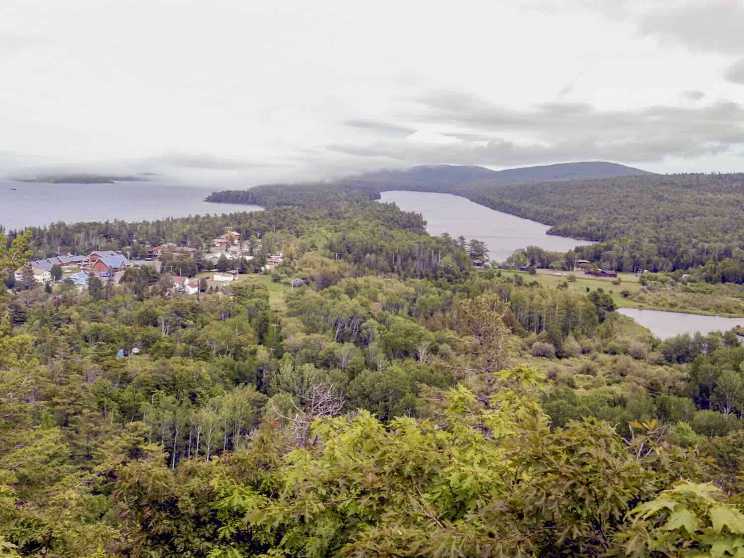
The town of Copper Harbor is in an area of scenic beauty. Above the town, the 8.5-mile Brockway Mountain Drive has several pullouts that afford scenic views. It’s one of several scenic drives in the Keweenaw. At the top of the mountain (1328 feet) I was amazed at the panoramic view of Lake Superior and some of the inland lakes of the Keweenaw, as well as the town of Copper Harbor.
Boomer Travel Tip
Need to update your road trip gear? Start with our recommendations for best road trip gear.
Visit Fort Wilkins State Historic Site
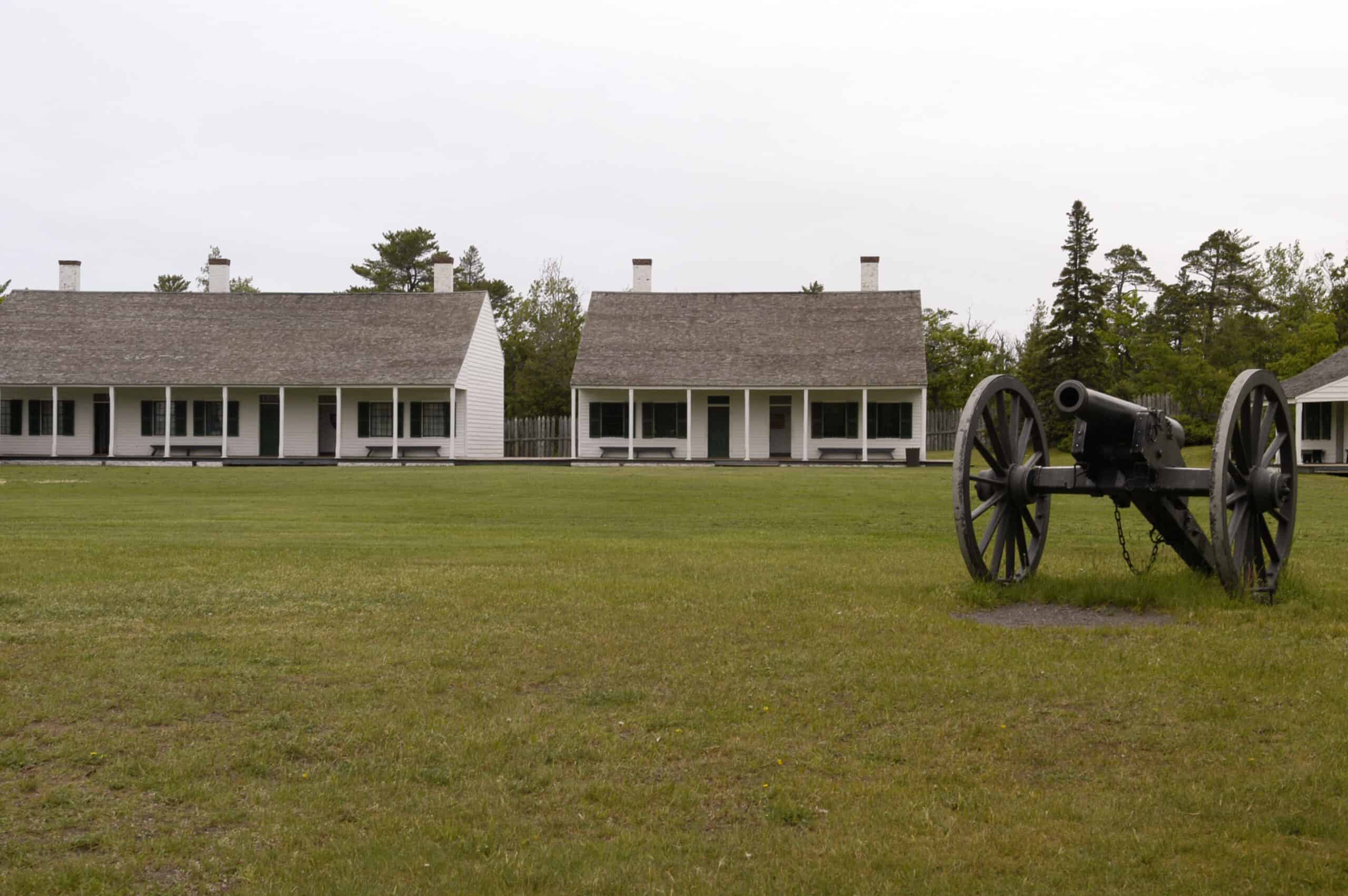
Fort Wilkins State Historic Site (website) is a restored 1844 frontier army base originally built to protect the port in the early years of the copper mining boom.
Don’t miss Estivant Pines Nature Sanctuary
Estivant Pines Nature Sanctuary is a 570-acre sanctuary that contains one of the last old growth pine stands in the state and is close to Fort Wilkins. We spent time visiting both of these landmarks.
Explore the Keweenaw Peninsula lighthouses
Lighthouses are very popular destinations whether accessible by foot, car, or boat. The Upper Peninsula has over fifty lighthouses and range lights.
The Copper Harbor Lighthouse is a definite must-see, but can only be visited via boat. Tours leave from the Copper Harbor Marina by way of Noah’s Ark Charters (website). Check their website for times and current fees.
Of course, many of the lighthouses are not opened to the public. And many are only accessible by boat, but that is half the fun in discovering lighthouses…getting to them.
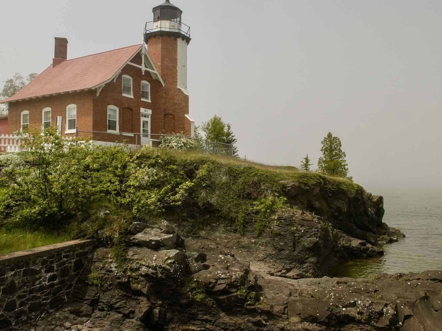
One we were able to drive to was the Eagle Harbor Light, one of several light stations that guide mariners on Lake Superior across the northern edge of the Keweenaw Peninsula.
Lake Superior, called “kichigame” by the Ojibwa Indians, is distinctive among the Great Lakes. It is by surface area the world’s largest freshwater lake and contains about ten per cent of all the earth’s fresh water.
The deepest point in Lake Superior (about 40 miles north of Munising, Michigan) is 1300 feet. It is about 350 miles in length and 160 miles in width. It is notorious for the number of shipwrecks that have occurred in its waters and has earned the reputation for being the most treacherous of the Great Lakes, thus the numerous lighthouses.
Save time for Isle Royale National Park
A ferry connects Isle Royale National Park (website) to northern Michigan. Isle Royale is part of the state of Michigan and offers an isolated wilderness retreat. On our trips, my wife and I didn’t have time to visit the island but heard of its ruggedness and solitude.
Pictured Rocks National Lakeshore: a popular UP destination
The thirty-five miles of coastline along Lake Superior from Munising to Grand Marais has a designation of Pictured Rocks National Lakeshore, one of only four with that distinction. The other three are the Sleeping Bear Dunes on Lake Michigan, the Indiana Dunes in Indiana on southern Lake Michigan, and the Apostle Island National Lakeshore on Lake Superior in Wisconsin.
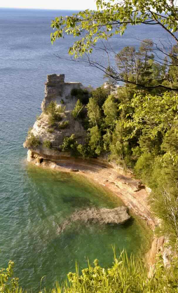
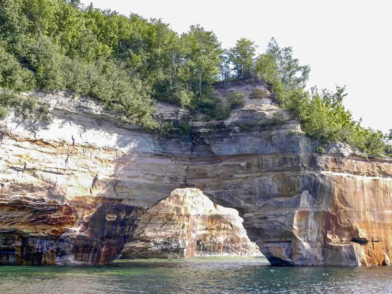
The Pictured Rocks National Lakeshore, which extends 42 miles along the Lake Superior coastline, is one of the outstanding natural attractions of the Upper Peninsula. The sandstone cliffs tower up to two hundred feet above the lake’s surface. The cliffs are painted by the mineral deposits in the rocks.
Because of the weather, the erosion, and the pounding of the rough water, the cliffs have been molded and carved to take on a variety of shapes, most of which have names, like Miner’s Castle, Lovers Leap, Indian Head, Grand Portal, Chapel Rock, Battleship Rock, and Indian Drum.
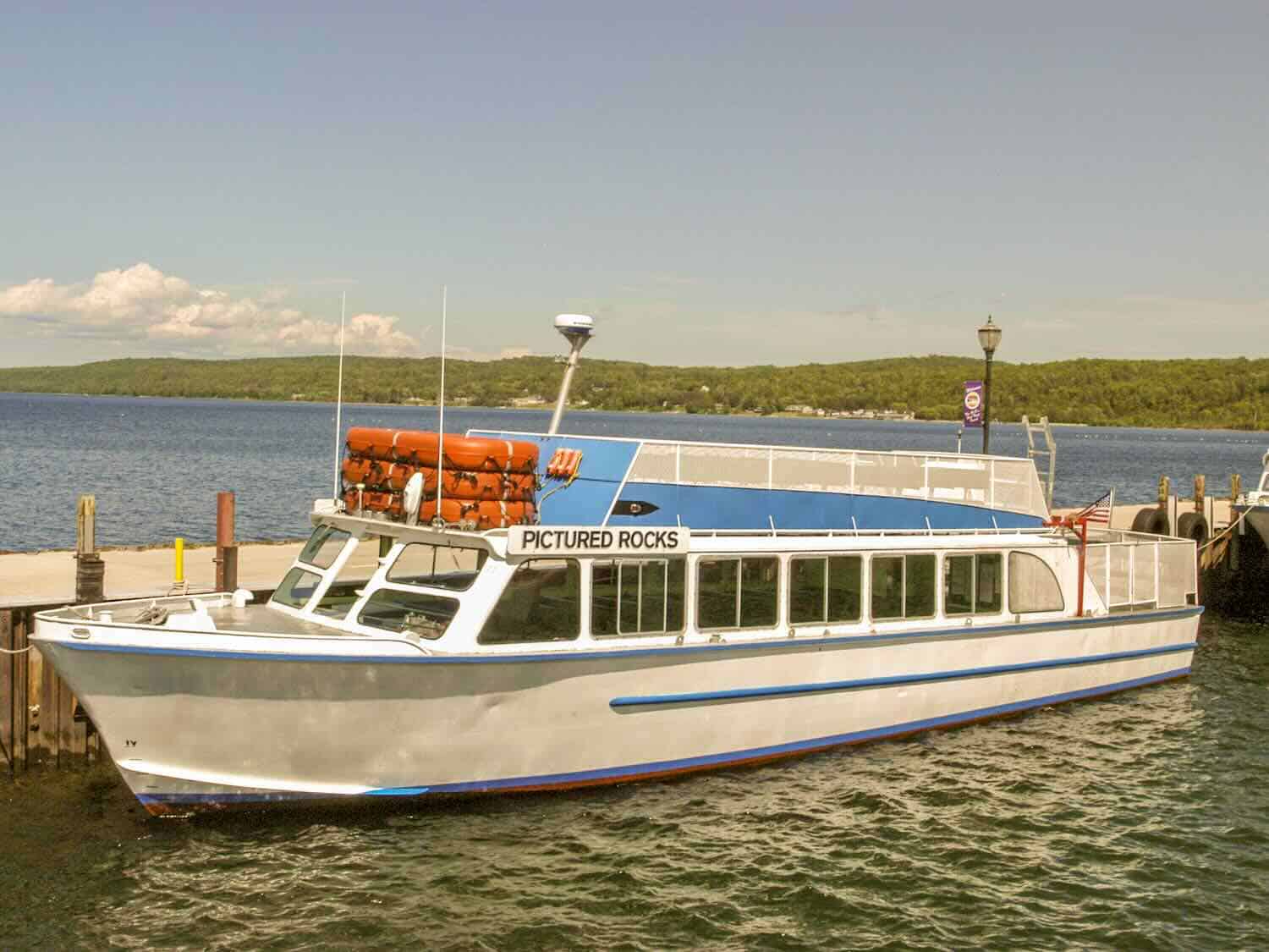
A three-hour boat cruise that leaves from the Munising harbor is an excellent way to see the Pictured Rocks up close and from the water. It’s one of the highlights of all our trips to the Upper Peninsula.
Grand Sable Dunes and Sable Falls
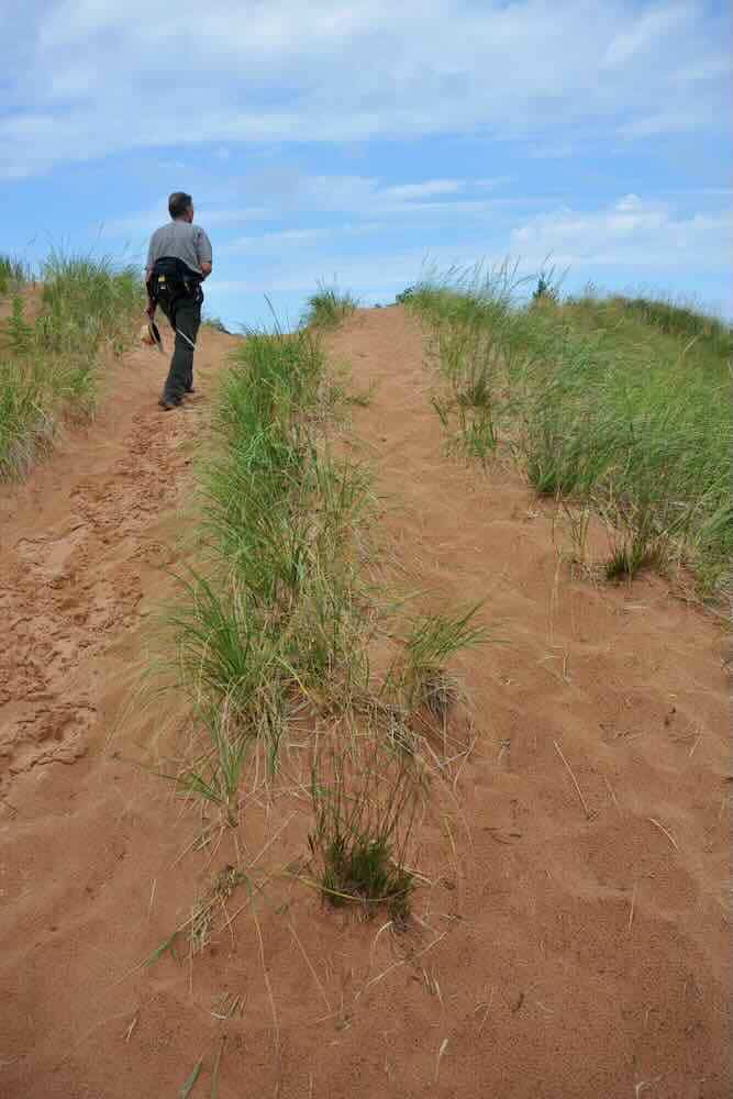
Grand Marais, at the eastern end of the Pictured Rocks National Lakeshore, is the most convenient way to get to another unique feature. The Grand Sable Dunes (website) and Sable Falls have a half-mile trail that leads to the dunes and passes through an old orchard, over a creek, and through a jack pine forest before it enters the dunes.
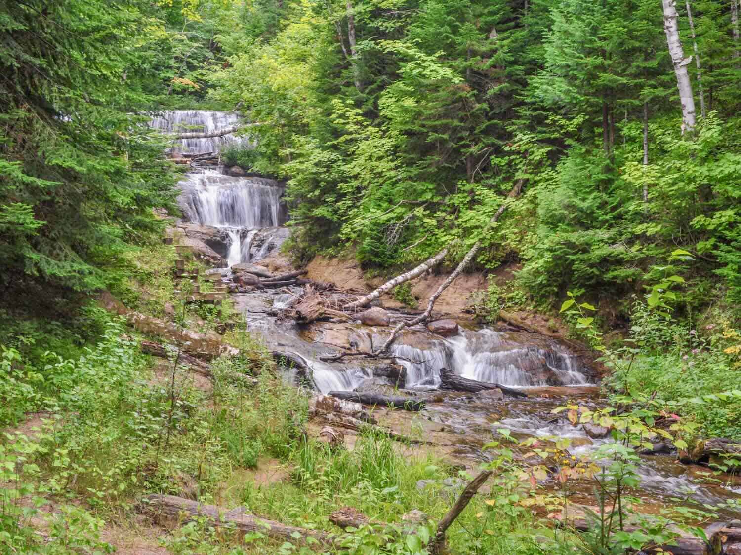
The high dunes cover a five mile stretch between the Sable River and Au Sable Point. Sable Falls is a short one-half-mile walk from the parking lot. There are a number of stair steps involved, but we found the walk worth the effort.
Hiawatha National Forest
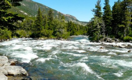
We also investigated parts of the two units of the Hiawatha National Forest (website). With over one million acres there are six wilderness areas and five National Wild and Scenic Rivers within its borders that provide a playground for year round outdoor activity.
Hiawatha touches all of the three Great Lakes of the UP and contains a 26-mile scenic byway along Lake Superior’s south shore. There are several trails scattered throughout the national forest for biking, snowmobiling, and cross-country skiing.
We took a couple of the shorter trails but the snowmobiling sounded like fun, if we had made any of the trips in winter. After all, the UP receives some of the heaviest snowfalls in the continental U.S. And within the UP, the Keweenaw Peninsula has the highest average annual snowfall amounts.
Whitefish Point
Because of the dangerous waters of the Great Lakes, and in particular, Lake Superior, lighthouses became important structures along the coastlines. On a piece of land jutting out into Lake Superior separating it from Whitefish Bay is Whitefish Point and another of the interesting destinations of the UP.
At Whitefish Point, called the “Graveyard of the Great Lakes”, as it is dubbed, is the site of the first lighthouse on Lake Superior and also, appropriately, the Great Lakes Shipwreck Museum (website). Within the museum are interesting artifacts of various shipping disasters, including the Edmund Fitzgerald, about which a song was written. Incidentally, the cause of its sinking is still a mystery.
Wawatam and Old Mackinac Point Lighthouses
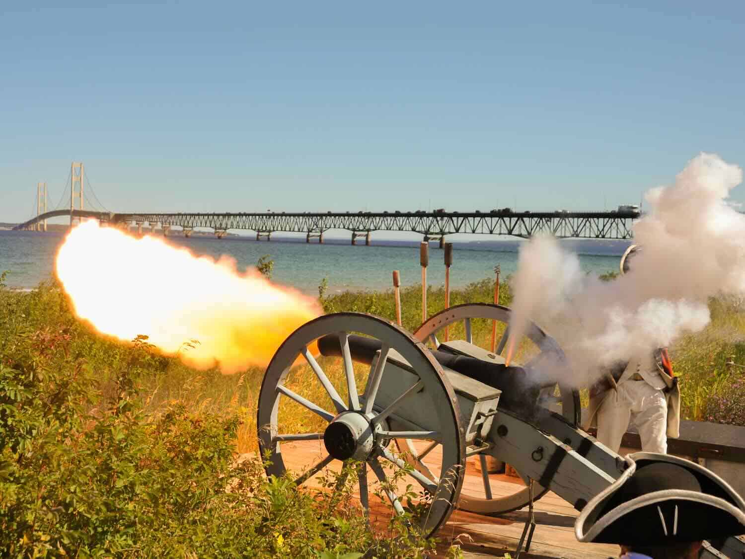
Wawatam and Old Mackinac Point Lighthouses are on the southern point of the Eastern UP. Wawatam is located in St. Ignace and the Old Mackinac Lighthouse is across the Mackinac Bridge near Colonial Michilimackinac (website) which is a historical complex with a fort and the lighthouse. We visited the fort with its impressive view of the bridge and lighthouses.
Mackinac Bridge
The Mackinac Bridge is a suspension bridge that spans the Straits of Mackinac. It connects the Upper and Lower Peninsulas of the state. The length of the bridge’s main span is 3,800 feet, which makes it the third-longest suspension span in the United States.
Tahquamenon Falls
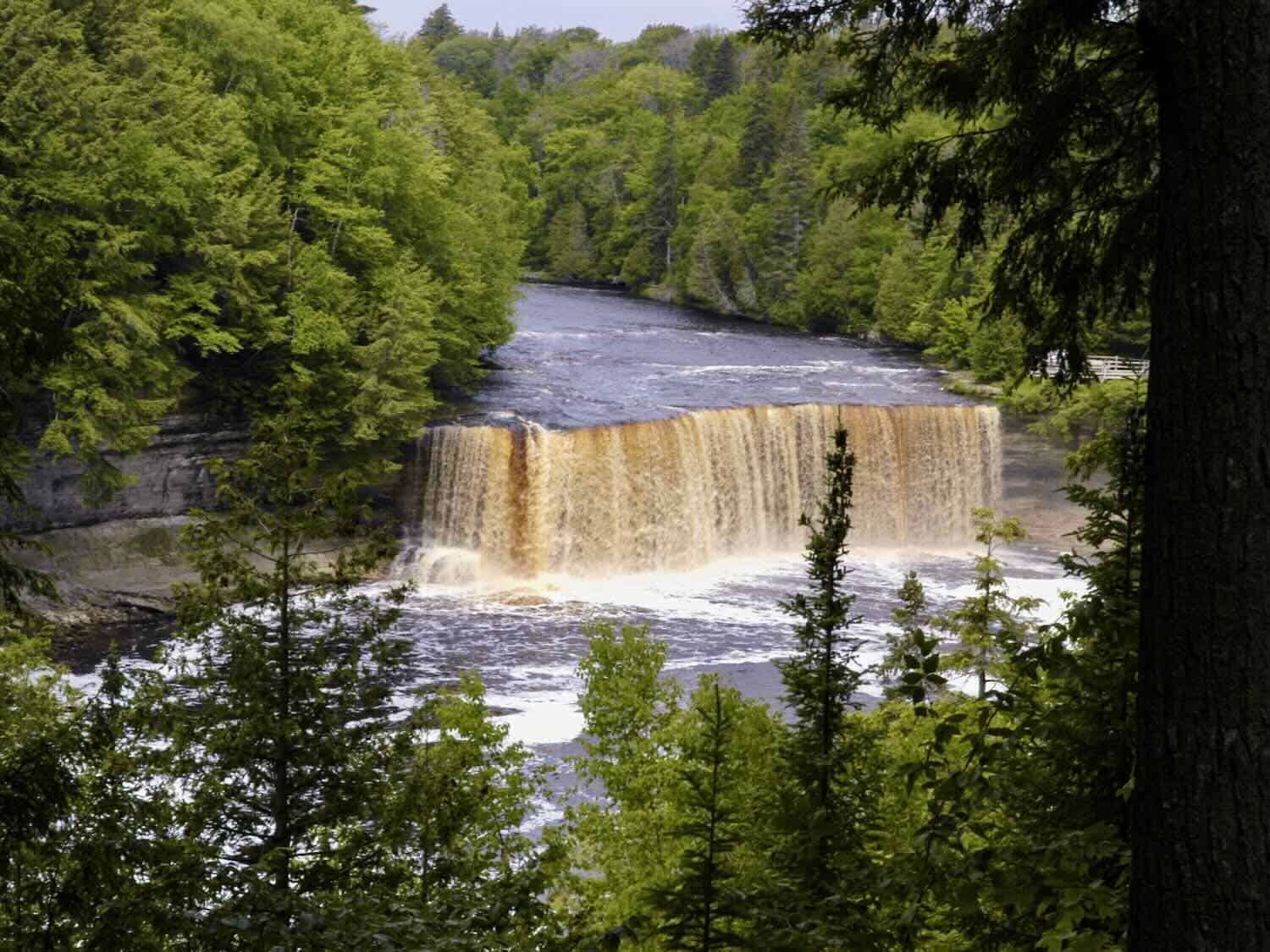
Tahquamenon Falls State Park contains one of the most scenic waterfalls in the UP. The park covers about 46,000 acres, most of which is undeveloped woodlands.
There are two waterfalls in the Tahquamenon River – the Upper and Lower. The Upper Falls is one of the largest waterfalls east of the Mississippi River and has a drop of almost fifty feet. It is more than 200 feet across and a flow of more than 50,000 gallons per second has been recorded.
We took the paved pathway of less than one half mile that leads from the parking lot at the Upper Falls through an old growth forest to observation platforms at the crest of the Falls. There are also steps leading to the bottom of the falls enabling visitors to view the water as it plunges into the Tahquamenon River.
A trail leads from the Upper to the Lower Falls. The Lower Falls is a series of five smaller falls cascading around an island, but are not as dramatic as the Upper. The Tahquamenon River then flows seventeen miles from the Lower Falls into Lake Superior.
Sample a Pasty
One food item we had heard about and wanted to try that seemed specific to the UP is the pasty (pronounced pass’-tee), a simple food that originated in Cornwall, England.
The pasty started as a working lunch for miners since it was easy to carry. It can be described as a “pot pie without the pot,” and basically consists of vegetables and meat wrapped in a crust. We tried it and found it very satisfying, especially after hiking a bit.
East vs West on the Upper Peninsula
The main difference in the eastern and western parts of the Upper Peninsula is the terrain. The extreme western part is more hilly and the flatter eastern portion has more marsh lands. Mining was the primary endeavor of the west, but logging and farming is more suitable in the east.
Outdoor activities in both parts are similar. Visitors to both have plenty of opportunity for hiking and biking, canoeing, kayaking, fishing, boating, and all types of other outdoor recreation.
The largest city in the Eastern UP is Sault Ste. Marie (pronounced soo saint marie). The city was named by the French and gets its name from the nearby rapids in the St. Mary’s River, which were called Les Saults de Sainte Marie.
The St. Mary’s River separates the U.S. and Canada, and also joins Lakes Superior and Huron. The Soo Locks, a popular visitor attraction, are located at Sault Ste. Marie in the St Mary’s River. The altitude difference in the two lakes (Lake Superior is about twenty feet higher than Lake Huron) makes the locks necessary.
The Upper Peninsula of Michigan covers a large area with many things to do and places to see. The Keweenaw Peninsula, Pictured Rocks National Lakeshore, Hiawatha National Forest, Tahquamenon Falls State Park, Colonial Michilimackinac, the Mackinac Bridge, Soo Locks, and Whitefish Point are some of the prime destinations of the UP for visitors that enjoy outdoor recreation and scenery.
But there are many other opportunities and attractions too many to list. Several museums give insight to the UP’s mining and shipping heritage. There are golf courses and thousands of acres of water to enjoy all types of nautical activities.
With all the possibilities for recreation and discovery, the Upper Peninsula is a surefire destination for the active and inquisitive traveler. Explore the UP. You might even like it so much, you might become a Yooper.